In today’s fast-paced world, knowing where you are and where you’re going is more crucial than ever. That’s where the growing importance of location-based services comes into play. From finding the nearest coffee shop to navigating through unfamiliar cities, these services have become an integral part of our daily lives.
Now, let’s talk about the technology behind it all: GNSS and GPS. You might be wondering, what’s the difference? Well, I remember the first time I used GPS on my phone; I was amazed at how it pinpointed my location in seconds. But little did I know, there’s more to it than just GPS. There’s a whole world of positioning technology out there, led by giants like Leica and Trimble.
When it comes to positioning technology, Leica and Trimble are the names that stand out. These two companies have been at the forefront of innovation, providing solutions that are not only accurate but also reliable. Whether it’s surveying, construction, or agriculture, Leica and Trimble have made their mark as global leaders in this field.
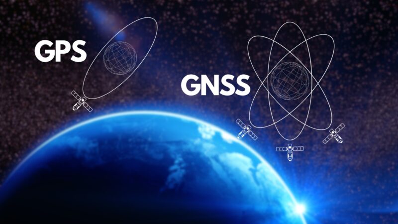
GPS
GPS, or Global Positioning System, is a satellite-based navigation system that allows users to determine their approximate location (latitude, longitude, and altitude) anywhere on Earth. It’s like having a personal guide in your pocket, always ready to show you the way.
The system consists of a constellation of at least 24 satellites orbiting the Earth. These satellites communicate with receivers, like the one in your smartphone, to provide accurate location data.
While GPS is incredibly useful, it’s not without its limitations. The accuracy can vary depending on factors like atmospheric conditions, signal obstruction, and the quality of the receiver.
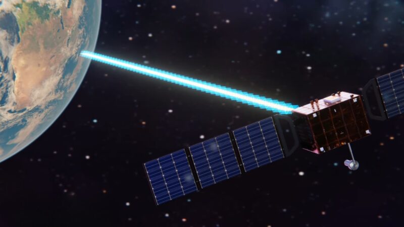
Prepare to be amazed as we delve into the intricate workings of a GPS robot and uncover the fascinating technology behind it.
| Factor | Effect on Accuracy |
| Atmospheric Conditions | Can cause delays in signal transmission |
| Signal Obstruction | Buildings or natural barriers may block signals |
| Receiver Quality | Higher quality receivers provide better accuracy |
GNSS
GNSS, or Global Navigation Satellite System, is a broader term that encompasses various satellite navigation systems, including GPS. Think of GNSS as the umbrella, and GPS is just one of the systems under it.
GNSS includes several systems, each with its unique characteristics:
| System | Origin | Number of Satellites |
| GPS | USA | 24+ |
| GLONASS | Russia | 24 |
| Galileo | European Union | 22+ |
| BeiDou | China | 35+ |
GNSS has revolutionized the way we navigate. Unlike traditional methods that relied on physical landmarks and maps, GNSS provides real-time, accurate location information. Whether you’re hiking in the wilderness or navigating through a bustling city, GNSS has made getting around easier and more efficient.
Leica
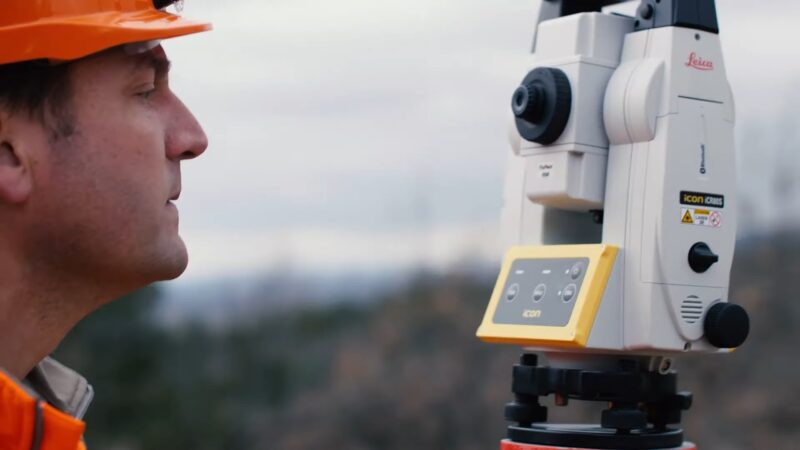
Leica Geosystems, a name synonymous with precision and innovation, has been a trailblazer in the world of positioning technology. From the early days of optical instruments to the cutting-edge GNSS receivers, Leica has been shaping the way we see and measure the world.
Their positioning technology is a blend of sophisticated engineering and user-friendly design. Whether it’s surveying, mapping, or construction, Leica offers a wide range of solutions to meet the diverse needs of professionals.
Leica receivers are known for their precision, robustness, and versatility. Here’s a snapshot of what sets them apart:
| Feature | Description |
| High Accuracy | Utilizes advanced algorithms for precise measurements |
| Multi-Frequency | Supports multiple GNSS systems for enhanced coverage |
| Rugged Design | Built to withstand harsh environmental conditions |
Trimble
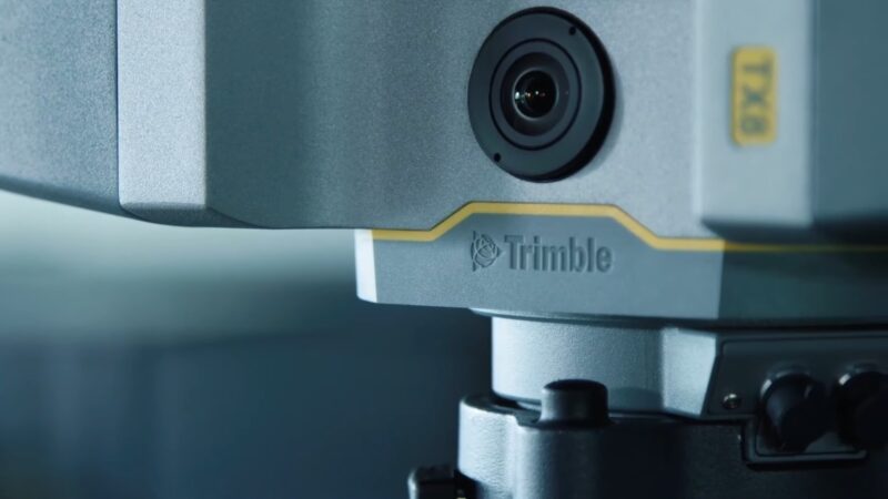
Trimble Navigation, is the other global leader in positioning technology, and has been redefining the boundaries of navigation and mapping. With a focus on innovation and sustainability, Trimble’s solutions are empowering industries like agriculture, construction, and transportation.
Fun Fact: Trimble was one of the first companies to utilize GPS technology for commercial applications.
Trimble’s technology portfolio is as diverse as it is innovative. From GNSS receivers to 3D modeling software, Trimble provides end-to-end solutions that are transforming the way we work and live.
Their products are designed with the user in mind. Here’s a glimpse of what makes Trimble stand out:
| Feature | Description |
| Integrated Solutions | Offers a seamless integration with various software and hardware |
| Scalable | Adaptable to different project sizes and complexities |
| Global Reach | Extensive network of dealers and support across the globe |
Differences Between GNSS and GPS
While GPS is a specific system with 24+ satellites, GNSS encompasses multiple systems, including GLONASS, Galileo, and BeiDou, with a combined total of over 100 satellites. This difference in coverage and satellite numbers leads to various advantages and limitations.
| System | Coverage | Number of Satellites |
| GPS | Global | 24+ |
| GNSS | Global (Enhanced) | 100+ |
Accuracy and Precision
Both GNSS and GPS offer high accuracy, but GNSS has the edge due to the integration of multiple satellite systems. This diversity allows for more precise measurements and reduces the chances of signal obstruction.
Global Reach and Regional Differences
While GPS is a global system, some GNSS components like BeiDou have a strong regional focus. These regional systems can provide enhanced services in specific areas.
Receiver Compatibility and Interoperability
Most modern receivers are compatible with both GNSS and GPS, allowing users to switch between systems or use them simultaneously for improved accuracy.
FAQ
What Is the Main Difference Between GNSS and GPS?
GNSS encompasses various satellite navigation systems, including GPS. In contrast, GPS is a specific system operated by the United States.
Can I Use GNSS and GPS Interchangeably?
Yes, most modern receivers support both GNSS and GPS. However, GNSS may offer enhanced accuracy due to the integration of multiple systems.
Which Is More Accurate: GNSS or GPS?
Generally, GNSS is more accurate as it utilizes multiple satellite systems, providing more data points for precise positioning.
How Does the Use of Multiple Satellite Systems Enhance GNSS Accuracy?
By accessing multiple satellite systems, GNSS can overcome limitations like signal obstruction, providing more reliable and accurate location information.
Are Leica and Trimble Receivers Compatible with All GNSS Systems?
Most Leica and Trimble receivers support various GNSS systems, offering flexibility and enhanced performance.
Conclusion
The world of positioning technology is vast and fascinating. From the ubiquitous GPS to the comprehensive GNSS, these systems have transformed the way we navigate and interact with our surroundings. Leaders like Leica and Trimble continue to innovate, pushing the boundaries of what’s possible.
Whether you’re a professional surveyor or just someone looking to find your way, understanding the key differences between GNSS and GPS can enhance your experience. Happy navigating!