
Geospatial information encompasses any data that is linked to a specific place on the Earth. This includes everything from the location of a street in a city to the changing patterns of global weather systems.
It’s a combination of spatial data (the ‘where’) and attribute data (the ‘what’ about the location). The sources of geospatial data are diverse. They range from census data providing demographic insights of a region, to satellite imagery capturing environmental changes.
Other sources include weather reports, mobile phone location data, including iPhone, and even posts on social media platforms. This variety of sources allows for a comprehensive view of the physical world and human interactions within it.
| Feature | Main Purpose |
|---|---|
| Location-Specific Information | Provides precise geographical positioning for various objects and phenomena |
| Time-Based Data | Allows for the analysis of changes and trends over time at specific locations |
| Vector Data (Points, Lines, Polygons) | Represents discrete geographical entities for detailed mapping and navigation |
| Raster Data (Pixelated Images) | Useful for representing continuous data like elevation or climate patterns |
| Spatial Analysis | Enables the examination of spatial relationships and patterns |
| Data Visualization (Maps, Graphs) | Facilitates understanding and communication of complex spatial data |
| GIS Technology | Supports data management, analysis, and visualization in a comprehensive system |
Types of Geospatial Data
There are two main types of geospatial data: vector and raster. Vector data is represented in points, lines, and polygons, ideal for depicting discrete data like roads, boundaries, and landmarks.
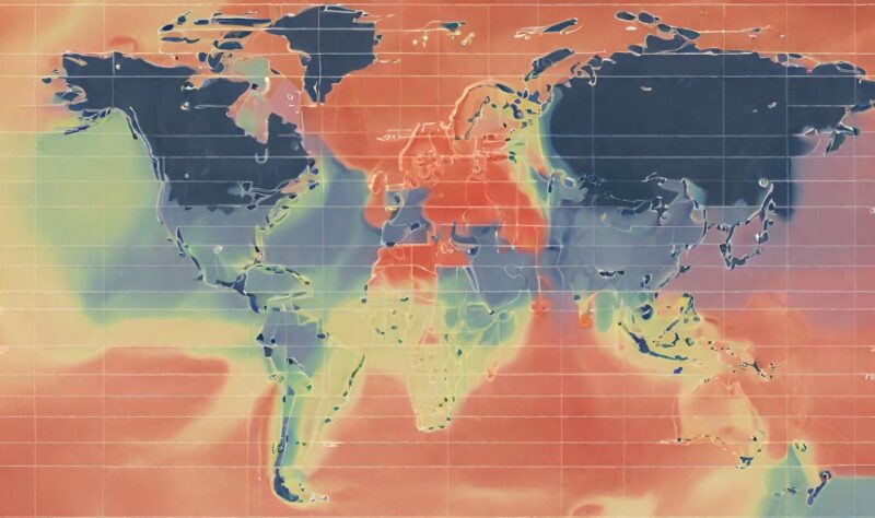
Raster data, on the other hand, is pixel-based and is used for continuous data like elevation or temperature maps.
- Characteristics of Vector Data: Vector data is highly accurate in representing the exact location and shape of geographical features. It’s typically used in mapping and navigation systems. Points in vector data can represent locations such as bus stops, lines can depict routes, and polygons can show areas like city limits.
- Characteristics of Raster Data: Raster data is especially useful in analyzing and visualizing continuous phenomena. Each pixel in a raster dataset has a value, making it ideal for representing gradients and variations across a space, such as in weather patterns or elevation models.
Geospatial Analytics
Geospatial analytics involves adding spatial and temporal dimensions to traditional data analysis. This means not just looking at ‘what’ and ‘where’, but also ‘when’.
Such analytics can lead to powerful visualizations like heat maps and temporal graphs, providing deeper insights into data.
- Applications of Geospatial Analytics: This form of analytics finds applications in various domains. For instance, it’s used in urban planning to analyze population growth patterns, in environmental management to monitor changes in land use, and in logistics for optimizing delivery routes. The versatility of geospatial analytics lies in its ability to combine multiple data sources and provide a comprehensive picture.
- Visualizing Data Through Maps and Graphs: One of the most compelling aspects of geospatial analytics is its ability to turn complex data into understandable and actionable visual formats. Maps and graphs not only make the data accessible but also help in identifying trends, anomalies, and opportunities for intervention.
Information Systems (GIS)
GIS involves the process of creating, managing, analyzing, and mapping all types of data.
GIS connects data to a map, integrating location data (where things are) with all types of descriptive information (what things are like there).
- The Role of GIS in Data Analysis: The strength of GIS lies in its ability to handle many different types of data and integrate them into a single, coherent framework. It provides a powerful platform for data analysis and decision making. For instance, in disaster management, GIS can be used to plan evacuation routes and allocate resources effectively.
- GIS and Visual Representations: Through GIS, raw data gets transformed into easy-to-understand visuals. This not only aids in better comprehension but also facilitates communication between different stakeholders, be they policy makers, scientists, or the general public.
What Are The Main Challenges?

Managing large sets of geospatial data presents several challenges, including storage, access, formatting, and the need for specialized expertise.
The sheer volume and complexity of data can be overwhelming, requiring robust systems and processes for effective management.
- Data Quality and Curation: The quality and curation of geospatial data are critical for its effective analysis. Inaccurate or incomplete data can lead to erroneous conclusions. Ensuring data accuracy, consistency, and relevancy is paramount for its practical application.
- Emerging Technologies for Efficient Management: Addressing these challenges, technologies like cloud-based solutions are emerging. For example, the IBM Environmental Intelligence Suite offers scalable solutions for managing geospatial data. These technologies not only handle the large volume of data but also provide tools for more efficient and accurate analysis.
Use-Cases and Applications

- Defense and National Security: In defense, geospatial analysis plays a crucial role in strategy and operations. It is used for tasks ranging from troop deployment to surveillance and reconnaissance, providing vital information about terrain and enemy positions.
- Social Sciences and Urban Planning: In the social sciences, geospatial data helps in understanding population dynamics, urban development, and socio-economic patterns. It’s a key tool in urban planning, aiding in the efficient design and management of cities.
- Natural Resource Management: In the realm of natural resource management, geospatial analysis is indispensable. It assists in tracking environmental changes, managing natural disasters, and conserving biodiversity, ensuring sustainable use of the Earth’s resources.
Use in Different Industries
Geospatial analytics finds its application in numerous industries. From disaster response and maintenance optimization in the public sector to risk assessment and credit scoring in finance, its versatility is unmatched.
- Industry-Specific Use Cases: In agriculture, geospatial analysis aids in precision farming, while in retail, it helps in market analysis and store placement. The transportation sector uses it for route optimization, and the energy sector for resource exploration and infrastructure management.
- Growing Market and Future Prospects: With the geospatial analytics market expected to reach USD 96.3 billion by 2025, its impact across different sectors is only set to grow. This growth underscores the increasing recognition of the value of spatial data and analysis in decision-making processes.
Further Development

- AI and Machine Learning: Geospatial technology is increasingly embracing advanced fields like AI and machine learning. These technologies are enhancing the capabilities of geospatial analysis, from improving the accuracy of predictions to automating complex processes.
- Drones and Autonomous Vehicles: The scope of geospatial technology is expanding with the advent of drones for aerial mapping and the development of autonomous vehicles. These innovations are not only expanding the types of data that can be collected but also the ways in which geospatial analysis can be applied.
FAQs
What are the 3 types of geospatial data?
Geospatial data primarily comes in three types: vector data, raster data, and temporal data. Vector data represents points, lines, and polygons, raster data is composed of pixelated images like photographs, and temporal data includes the time aspect in spatial locations.
What is the difference between geospatial data and data?
Geospatial data is a specific subset of data that includes information about geographical locations and spatial dimensions. In contrast, general data can be any type of information, not necessarily related to physical locations or spatial attributes.
How is geospatial data collected?
Geospatial data is collected through various methods such as satellite imagery, GPS technology, aerial photography, surveys, and by gathering information from sensors and IoT devices. This data can then be processed and analyzed for various applications.
Is Google Maps a GPS or GIS?
Google Maps is a GIS (Geographic Information System) as it provides detailed geographical information, mapping tools, and spatial analysis. It’s not a GPS (Global Positioning System) which is specifically a satellite-based navigation system providing location information.
Are maps geospatial?
Yes, maps are a form of geospatial data as they visually represent geographical areas, showing features and relationships between different physical locations on Earth. They are essential tools for understanding spatial information.
Summary
Geospatial data plays a crucial role in our comprehension and handling of various global aspects. It finds use across numerous domains including urban development, environmental conservation, defense, and the study of society.
As geospatial technology evolves, especially with the incorporation of AI and sophisticated data analysis methods, its capabilities and applications are broadening. Looking ahead, the skillful utilization and analysis of geospatial data will be key in tackling complex international issues and contributing to sustainable growth.